NATURAL RESOURCE MAPPING
Guiding Watershed Protection
Jan 2019 Update: A document has been released by the town of Bristol outlining the Natural Resources Inventory in the region and specifically the town boundaries. To view the document, follow this link: Click Here

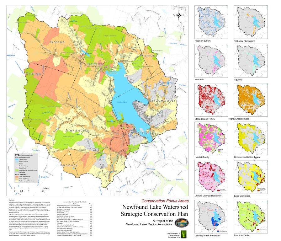
In the summer of 2017, our watershed mapping underwent great improvements due to up-to-date mapping resources and key stakeholders informing the mapping process. We accomplished this through the Delphi Process. We gathered key stakeholders for several educational workshops, after which they provided their opinions on the relative importance of key natural resources for the health of Newfound Lake and its tributaries. The collective results were used to create a resource co-occurrence map representative of priority areas in the watershed where several resources “co-occurred” in higher numbers.
For the preliminary briefing paper shown to participants at the educational workshop Click Here
JUNE 2017 UPDATE: For a Full Report for the Conservation Focus Areas Click Here
Final Results were presented on September 1st (below)
We also partnered with Plymouth State University to distribute a research project concerning public perceptions of the Newfound Watershed:
