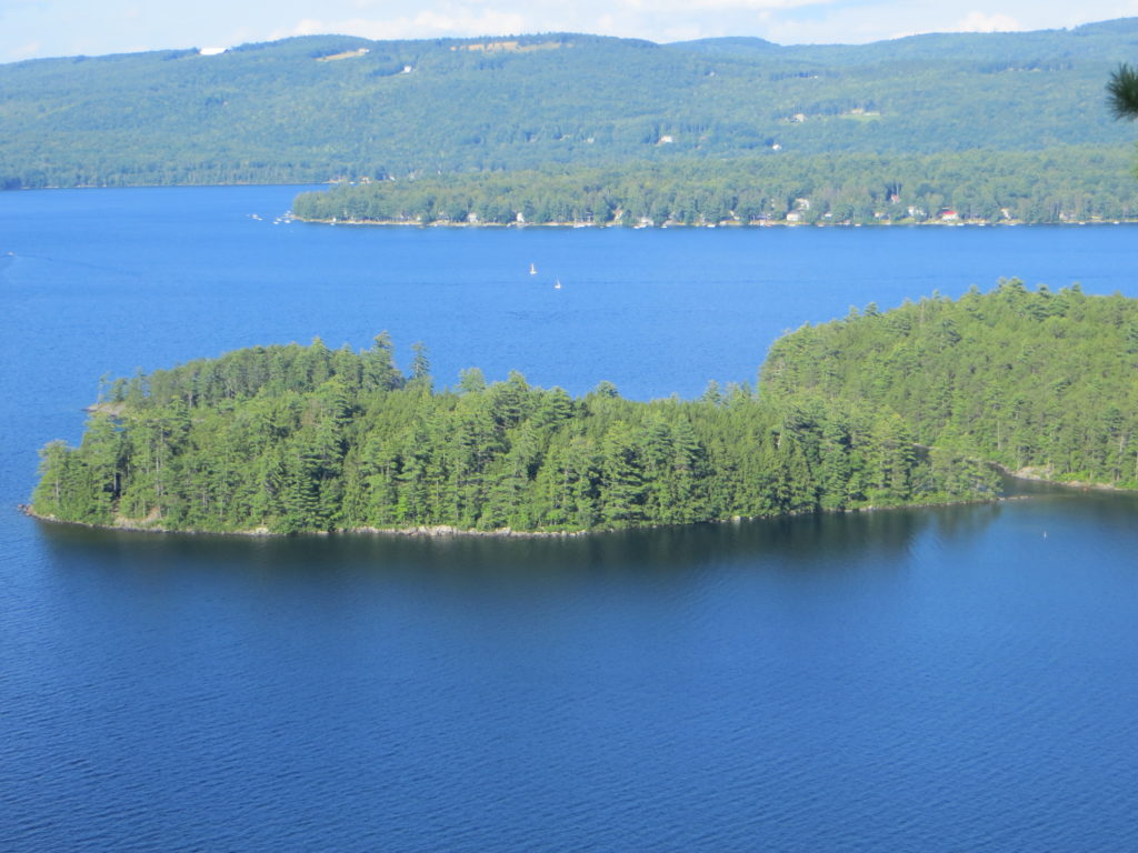
Everyone who enjoys the Newfound Watershed can see that we have clear water and healthy forests. Though this is true, without long-term monitoring and protection from an organization like the NLRA, it might be difficult to notice the slow decline in health of this watershed. On Thursday February 13, 2020 NLRA presented findings that have come from years of monitoring and research, and gave a report on the current state of the lake.
Water Quality
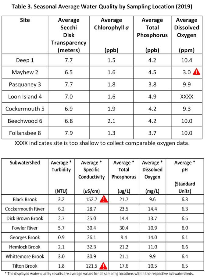
- 7 lake sites and 35 streams sites from 8 subwatersheds are monitored. Overall, the condition of the watershed is excellent. The lake sites and subwatersheds are listed below with the most recent data available.
- Lower levels of dissolved oxygen required for healthy fisheries in the bay south of Mayhew Island.
- High levels of conductivity, often caused by road salts, in southern tributaries like Tilton Brook and Black Brook.
- Slow declines in water quality for some sites, especially Pasquaney Bay, with a 10% decline in clarity and increase in Chorophyll a.
The tables below shows the available water quality for the lake sites (top) and stream sites are grouped together by subwatershed (bottom). Areas of concern are marked with a red triangle, indicating the site does not always meet the state’s standard for high quality, oligotrophic waters.
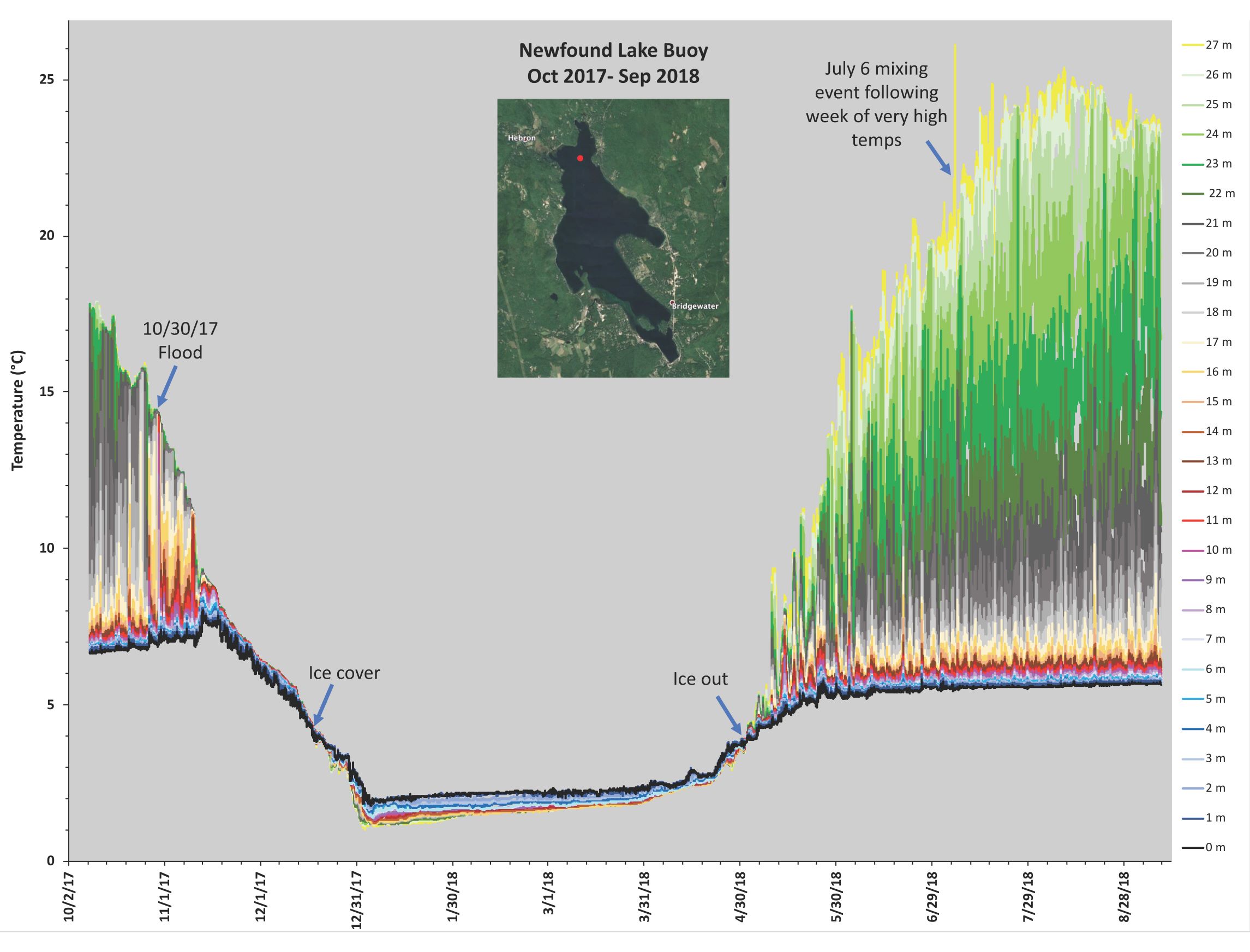
Research collaborations with the Plymouth State University give us a better sense of how Newfound Lake is behaving. The graph below was created by Lisa Doner, PhD and shows the range of temperature from the surface to the lake bottom with very little temperature difference in the winter and large variability in the summer. Notice that you can see weather events represented by a spikes or drops in temperature. We have marked a flood in late 2017 and a heat wave in July 2018.
FOR MORE INFORMATION ON WATER QUALITY CLICK HERE
Invasives
- Currently there are no aquatic invasive species in the Newfound Lake and tributaries. This is largely due to our prevention and early identification efforts. The Lake Host Program staffs the boat ramp and “Lake Hosts” inspect boats before entering the lake. Our Weed Watcher team is responsible for paddling along the shoreline to keep track of plant growth and the establishment of invasive plant colonies.
FOR MORE INFORMATION ON INVASIVE SPECIES CLICK HERE
Threats to the Lake
- Stormwater remains the biggest threat, carrying with it fertilizers, pesticides, vehicle fluids, and soil.
- Soil erosion is the largest input and brings nutrients, mainly phosphorus, to the lake that feed algae and cyanobacteria.
Evidence of sedimentation can be seen immediately after large storm events. During the July 12, 2019 storm, marked by the dotted red line, the water clarity dropped to less than 6ft from the normal 26ft of clarity. The river washouts in Hebron caused the lake to look very brown and murky, bringing clarity below state standards for a high-quality waterbody.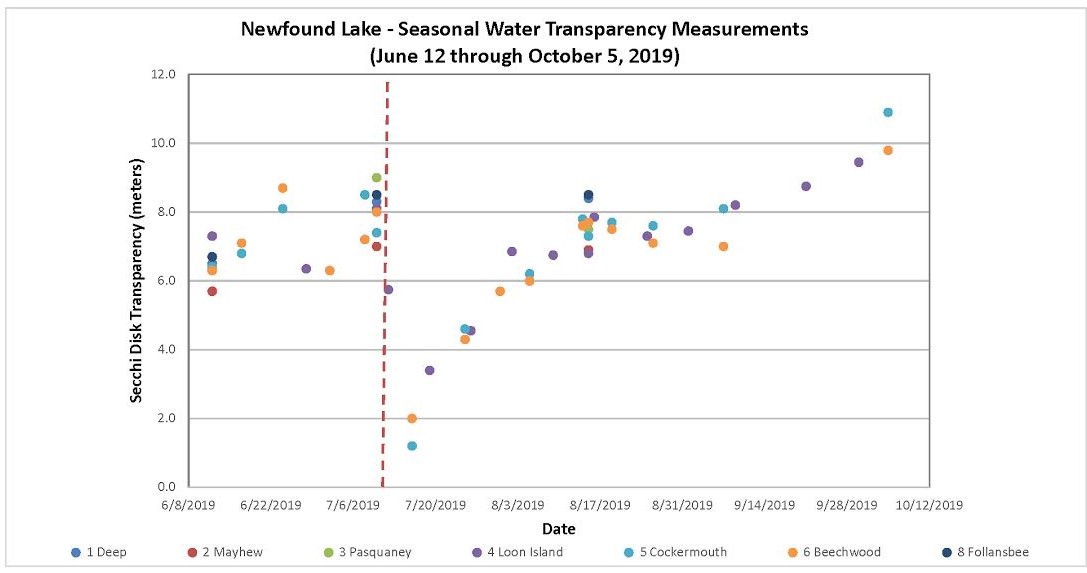
FOR MORE INFORMATION ON STORMWATER CLICK HERE
Lake Levels
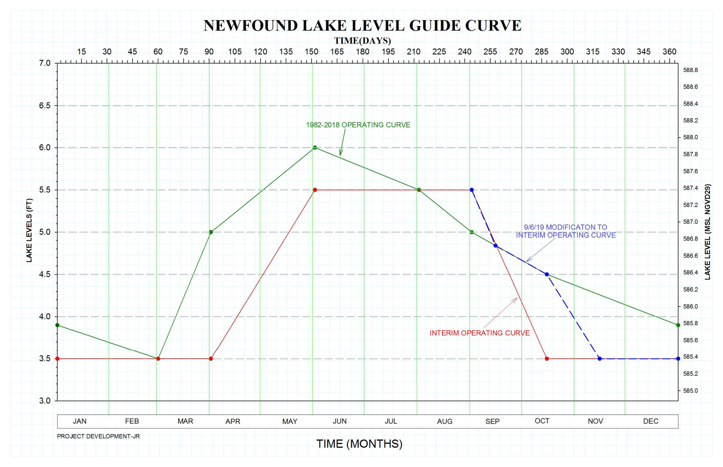
- The NH Dam Bureau is still investigating a change in the lake level management schedule, though currently operating on the schedule released in September 2019.
- The latest schedule, shown below, starts raising the lake from fall drawdown levels on April 1st and keeps the lake about 6” below the previous maximum target level through the summer. It also draws the lake down a month later in the fall, with the lowest target levels occurring in mid-November.
FOR MORE INFORMATION ON LAKE LEVEL CLICK HERE
Watershed Planning
- Links management, science and culture to protect Newfound
- We’ve carried out a number of large and small scale projects to reduce sediment and nutrient impact to Newfound.
FOR MORE INFORMATION ON WATERSHED PLANNING CLICK HERE

